Octave GeoMedia GIS 소프트웨어
공간 데이터 관리를 개선하는 강력한 GIS 플랫폼입니다. 다양한 출처의 정보를 통합하여 동적으로 분석하고, 팀과 인사이트를 공유해 보십시오.
실행 가능한 공간 인사이트를 분석 및 시각화하여 제공
데이터에서 의사결정까지, 업무의 혁신
GeoMedia는 지리공간 데이터를 실행 가능한 인사이트로 전환합니다. 2D 및 3D로 데이터를 시각화하고, CAD, GIS 및 데이터베이스 포맷을 통합하며, 동적 질의 및 네트워크 모델링을 통해 공간적 상관관계를 분석합니다. 상호 운용성을 위한 실시간 업데이트와 OGC 표준을 지원하는 동시에, 유연성, 성능 및 효율성을 바탕으로 도시 계획, 인프라 또는 엔터프라이즈 운영에서 더 스마트한 의사결정을 이끌어냅니다.

GIS 워크플로우를 강화하는 핵심 기능
GeoMedia는 데이터 처리, 시각화, 분석 및 협업을 위한 포괄적인 도구를 제공합니다. 2D 및 3D 매핑부터 고급 공간 분석과 원활한 데이터 공유에 이르기까지, GeoMedia가 어떻게 조직이 지리공간 데이터의 잠재력을 정확하고 신속하며 효율적으로 극대화할 수 있도록 지원하는지 확인해 보십시오.
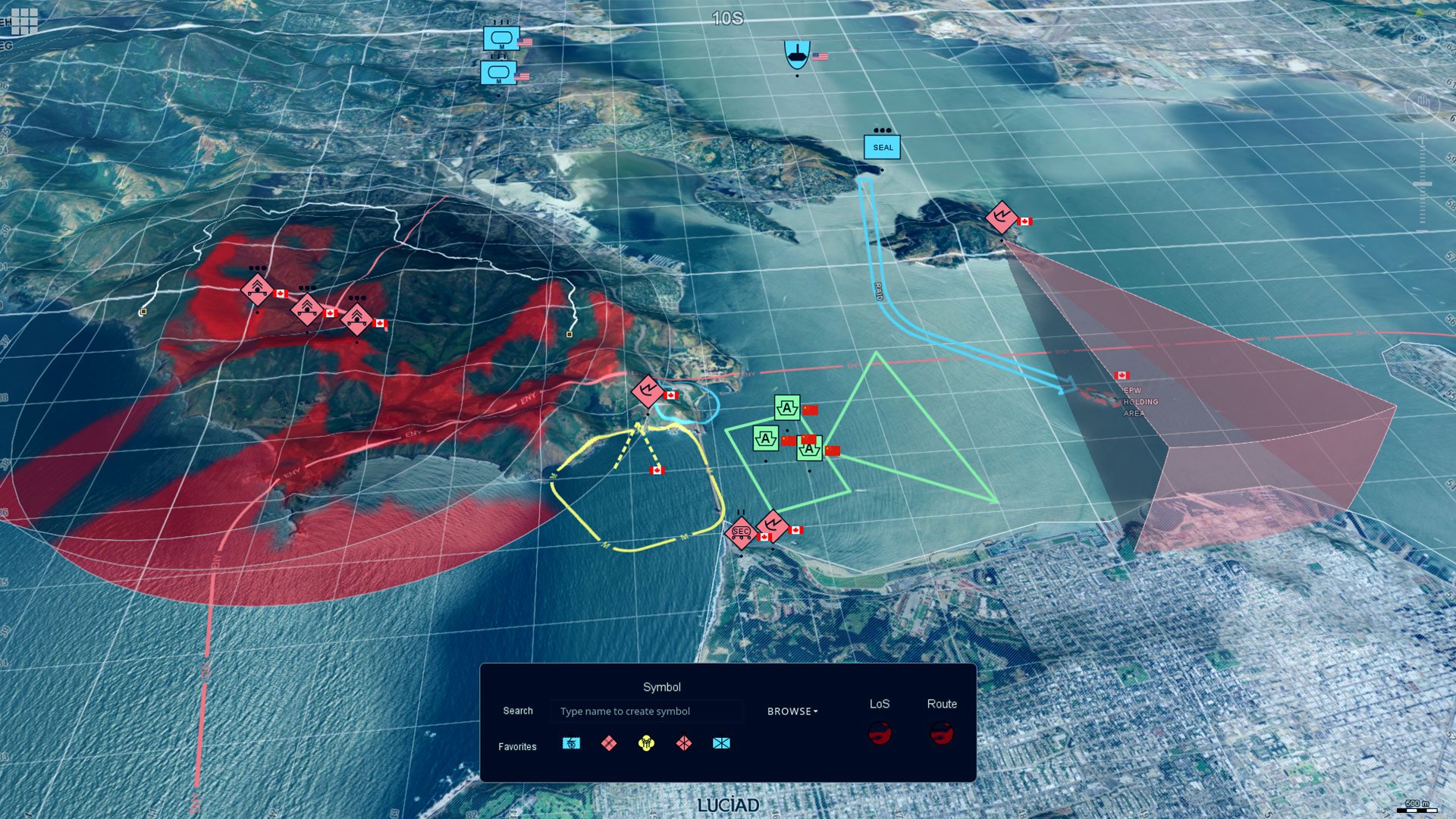
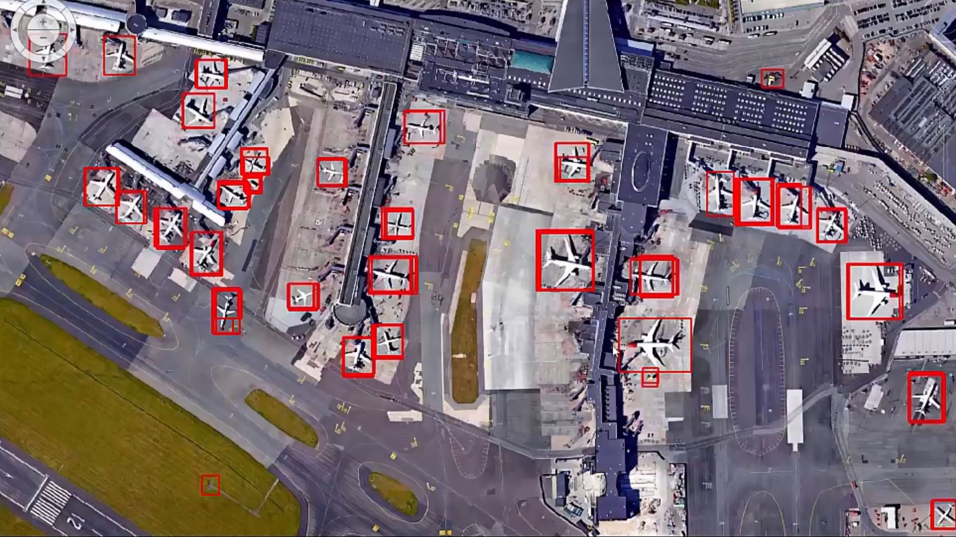
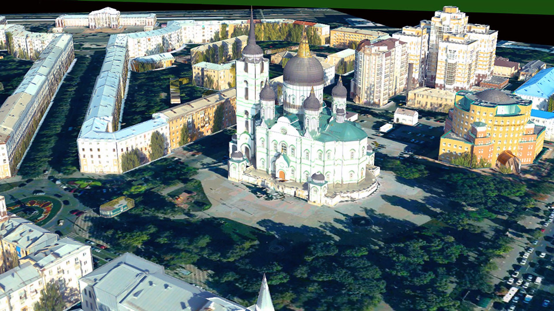
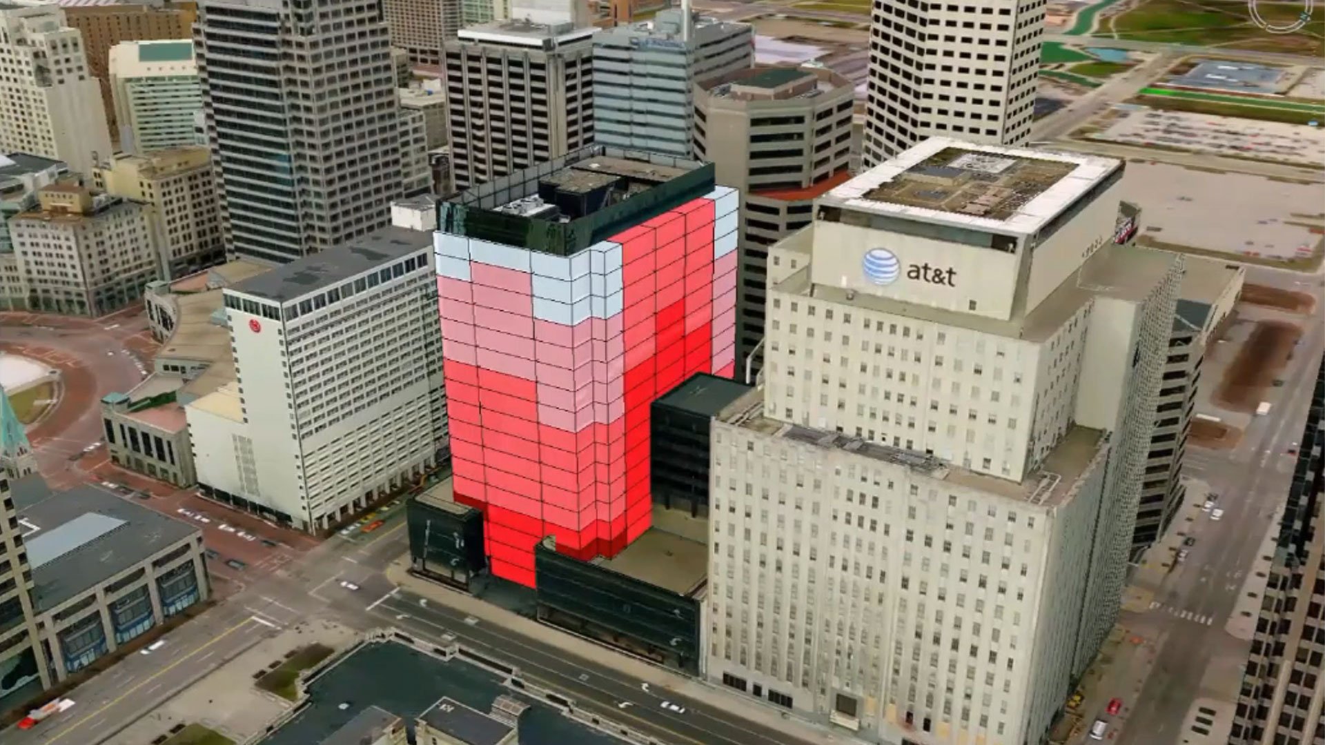
Advanced visualization in 2D and 3D
Create interactive maps, 3D models and dynamic reports. Display diverse data formats in one unified view to provide comprehensive spatial insights for better communication and decision-making.
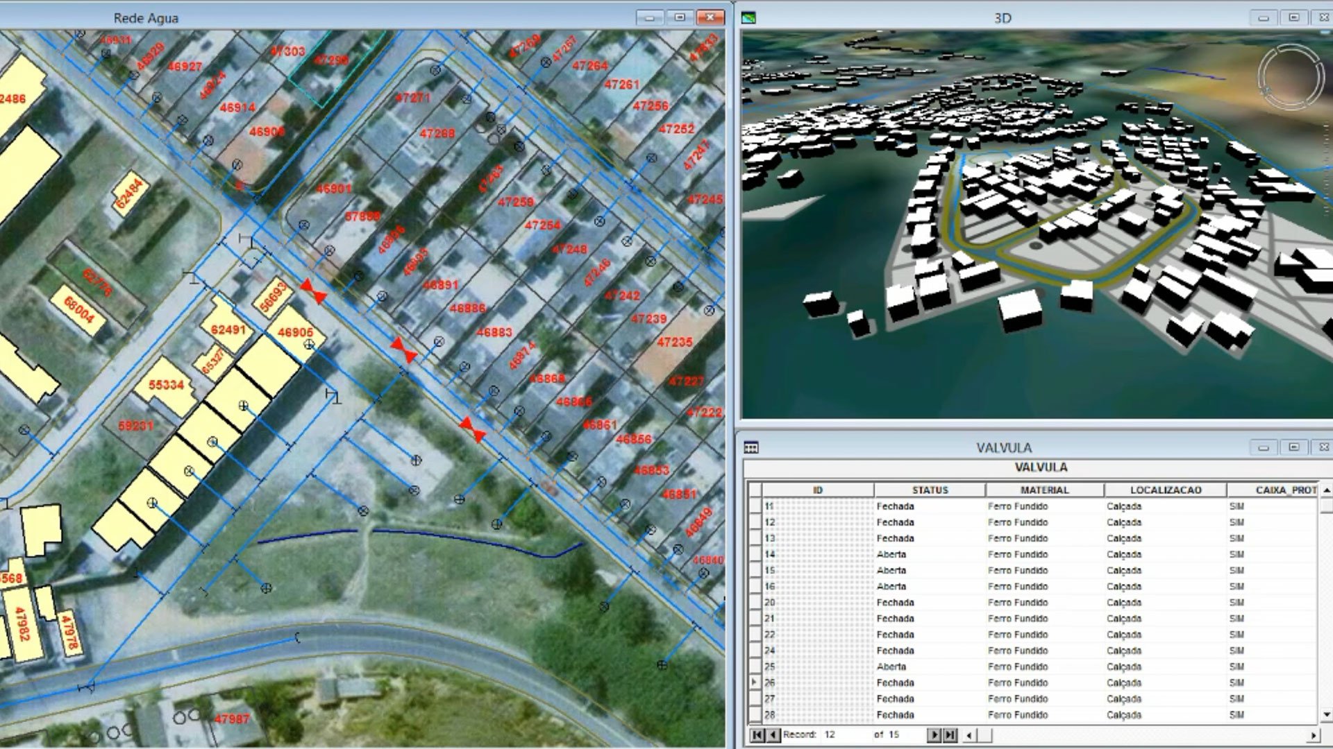
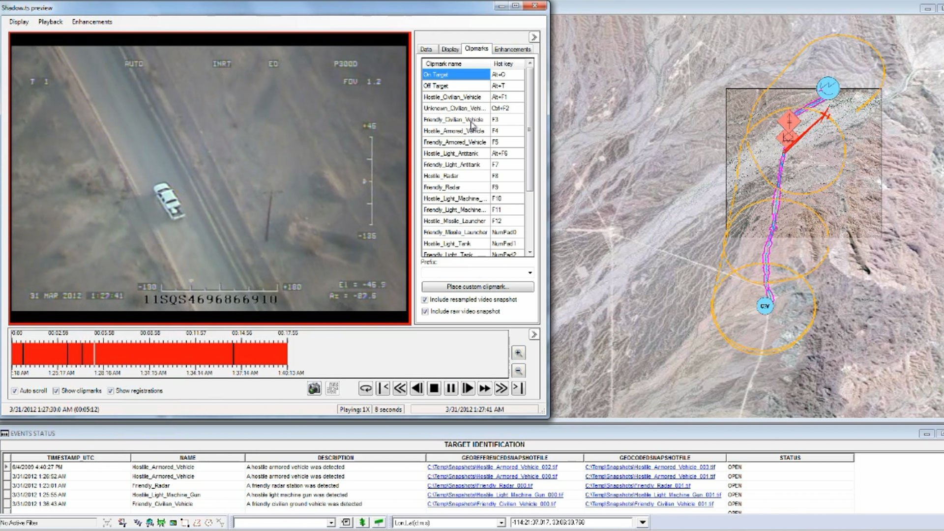
Powerful spatial analysis tools
Perform network modeling, dynamic segmentation and spatial overlays efficiently. Advanced analysis tools enable users of all skill levels to extract actionable insights from complex geospatial data.
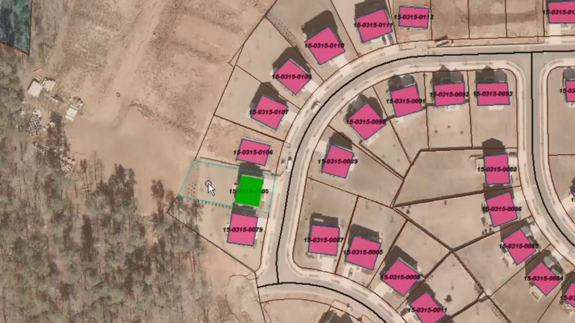
Seamless data integration
Support for 300+ data formats including CAD, GIS and database systems. Integrate information from multiple sources to create a unified view of your spatial data for comprehensive analysis.
Real-time data updates
Dynamically update analyses and visualizations as source data changes. Ensure your results are always current without redoing work, making GeoMedia ideal for time-sensitive applications and operations.
Industry-standard interoperability
Adhere to OGC protocols including WMS, WFS and WCS standards. Share geospatial data effortlessly across systems and collaborate seamlessly with other GIS tools and enterprise platforms.
Customizable workflows
Tailor user interfaces, workflows and analysis tools to align with your specific operational needs. Ensure seamless integration into your existing processes for maximum efficiency and productivity.
Explore the GeoMedia portfolio
GeoMedia is a powerful GIS platform that improves spatial data management. The wider GeoMedia portfolio encompasses a broad range of solutions. These include WebGIS, which transforms existing geospatial data into intuitive web applications; Octave ImageStation photogrammetry mapping technology; and Octave SafeHaul jurisdiction-based route optimization software that automates permitting, routing and restriction management for oversize / overweight (OS / OW) vehicles.

Extend and enhance your GeoMedia workflows
Unlock more capability in GeoMedia with a growing suite of add-ons designed to deepen analysis, streamline tasks and expand what your geospatial workflows can do. From advanced visualization to specialized data processing and operational tools, each add-on integrates seamlessly; helping you work smarter, faster and with greater confidence.
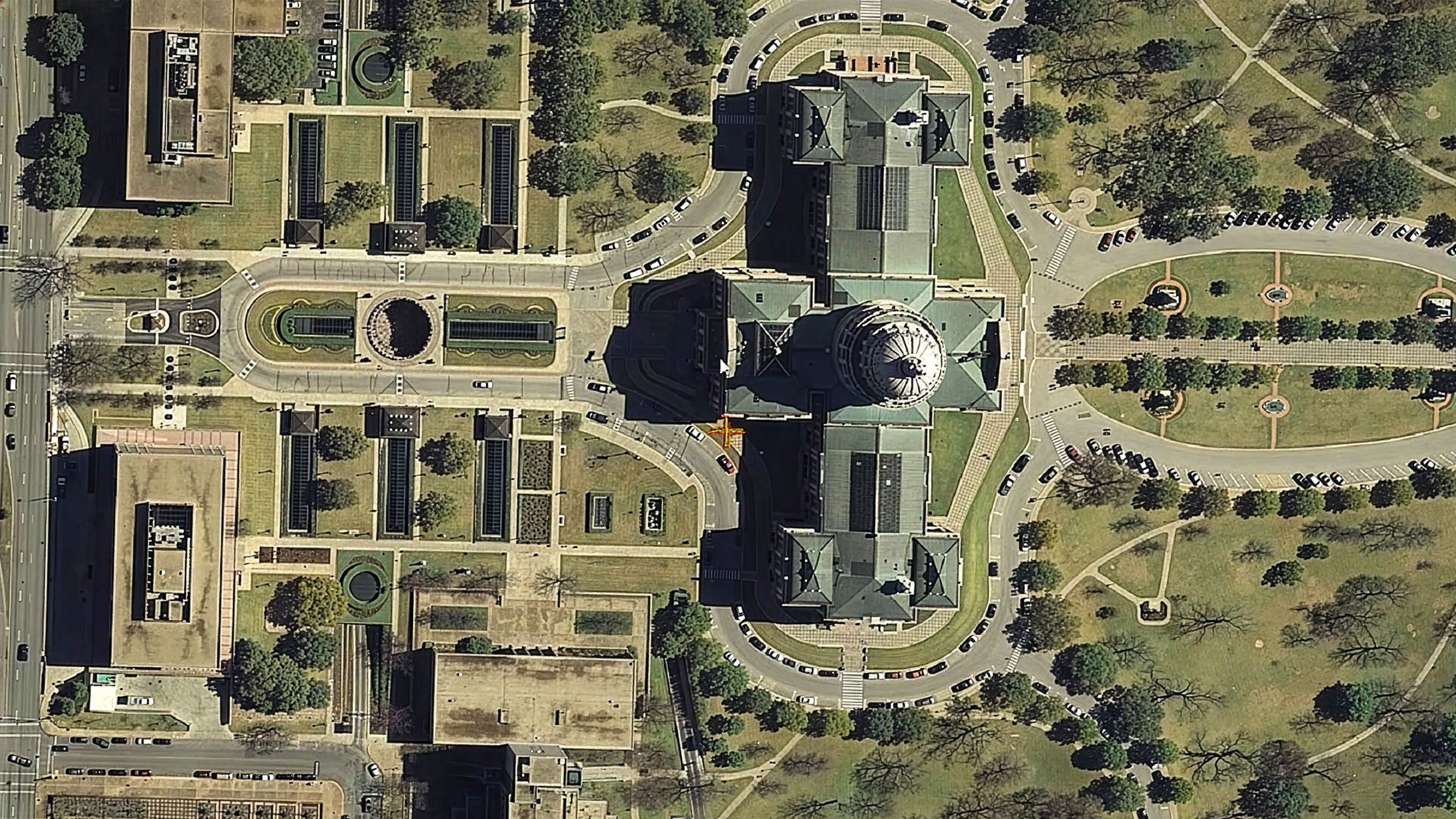
GeoMedia 3D 모델, 지형, 이미지를 선명하게 탐색할 수 있는 인터랙티브 3D 뷰를 제공합니다.
GeoMedia Motion Video 지리공간 데이터를 사용하여 UAV 비디오를 조회, 개선, 분석할 수 있습니다.
GeoMedia Mapping Manager Map Publisher와 Feature Cartographer를 통해 지도 제작 기능을 향상합니다.
GeoMedia Transportation Manager 기관이 선형 운송 네트워크를 모델링, 분석 및 유지보수할 수 있습니다.
GeoMedia Viewer 지도 데이터를 표시, 분석 및 인쇄하는 데 사용할 수 있는 무료 GIS 애플리케이션입니다.
GeoMedia Objects 개발자에게 맞춤형 애플리케이션을 위한 고급 GIS 및 지도 제작 도구를 제공합니다.
GeoMedia Advanced Collection MGCP 및 국제 매핑을 위한 대용량 벡터 데이터 캡처와 검증을 최적화합니다.
GeoMedia GI 툴킷 GeoMedia Professional에 더 빠른 데이터 수집, 통합 및 매핑을 위한 생산성 도구를 추가합니다.
GeoMedia Image Professional GIS 및 이미지 분석 워크플로우를 단일 통합 솔루션으로 결합합니다.
GeoMedia PDF 레이아웃 창의 지도 시트에서 직접 지능형, 지리 참조 PDF 파일을 생성합니다.
GeoMedia VPF 디지털 VPF 지도 제품 제작을 위한 전문적인 제작 환경을 제공합니다.
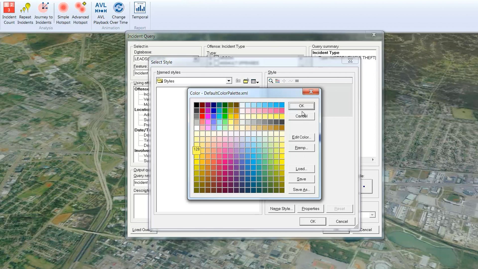
GeoMedia Incident Analyst 이벤트 기반 정보를 분석하고 이해하기 위한 직관적인 매핑 환경을 제공합니다.
Spatial Modeler SDK 지리공간 데이터를 처리하는 워크플로우를 구축, 수정 및 실행하기 위한 C++ 툴킷입니다.
고객 성공 사례
We're here to help
Get the help you need with direct access to support and resources.
지리공간 역량 확장
GeoMedia와 원활하게 연동되어 GIS, 매핑 및 위치 인텔리전스 역량을 강화하는 보완 제품을 확인해 보십시오.