Software GIS Octave GeoMedia
Efficace piattaforma GIS che migliora la gestione dei dati spaziali. Aggrega informazioni da più fonti, analizza dinamicamente e condividi approfondimenti con i team.
Analizza, visualizza e fornisci informazioni spaziali utili
Dai dati alla decisione — trasforma il tuo lavoro
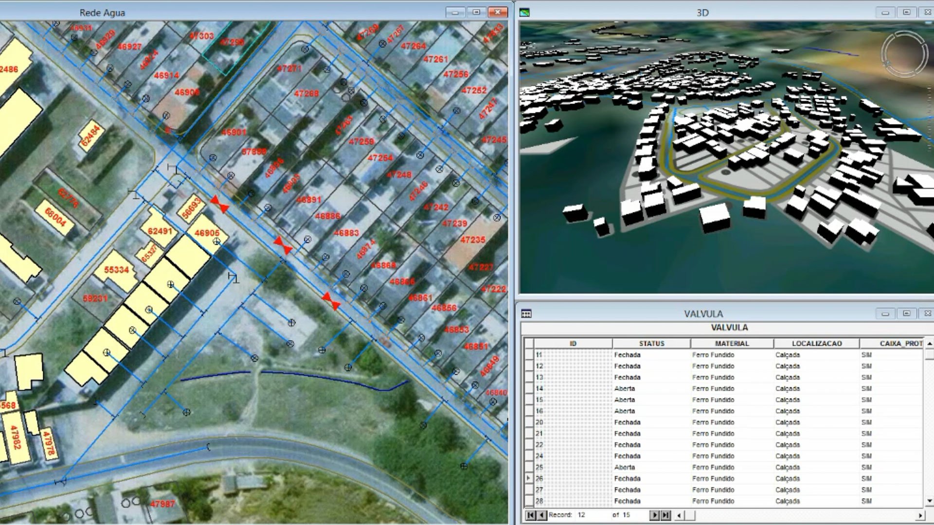
GeoMedia trasforma i dati geospaziali in informazioni utili. Visualizza i dati in 2D e 3D; integrare formati CAD, GIS e database; e analizzare le relazioni spaziali con query dinamiche e modellazione di reti. Supporto aggiornamenti in tempo reale e standard OGC per l'interoperabilità, favorendo al contempo decisioni più intelligenti grazie a flessibilità, prestazioni ed efficienza nella pianificazione urbana, nelle infrastrutture e nelle Operazioni aziendali.

Funzionalità chiave che potenziano i tuoi flussi di lavoro GIS
GeoMedia offre strumenti completi per l'elaborazione dei dati, la visualizzazione, l'analisi e la collaborazione. Dalla mappatura 2D e 3D all'analisi spaziale avanzata, fino alla condivisione fluida dei dati, scopri come GeoMedia aiuti le organizzazioni a sfruttare appieno il potenziale dei loro dati geospaziali con precisione, velocità ed efficienza.
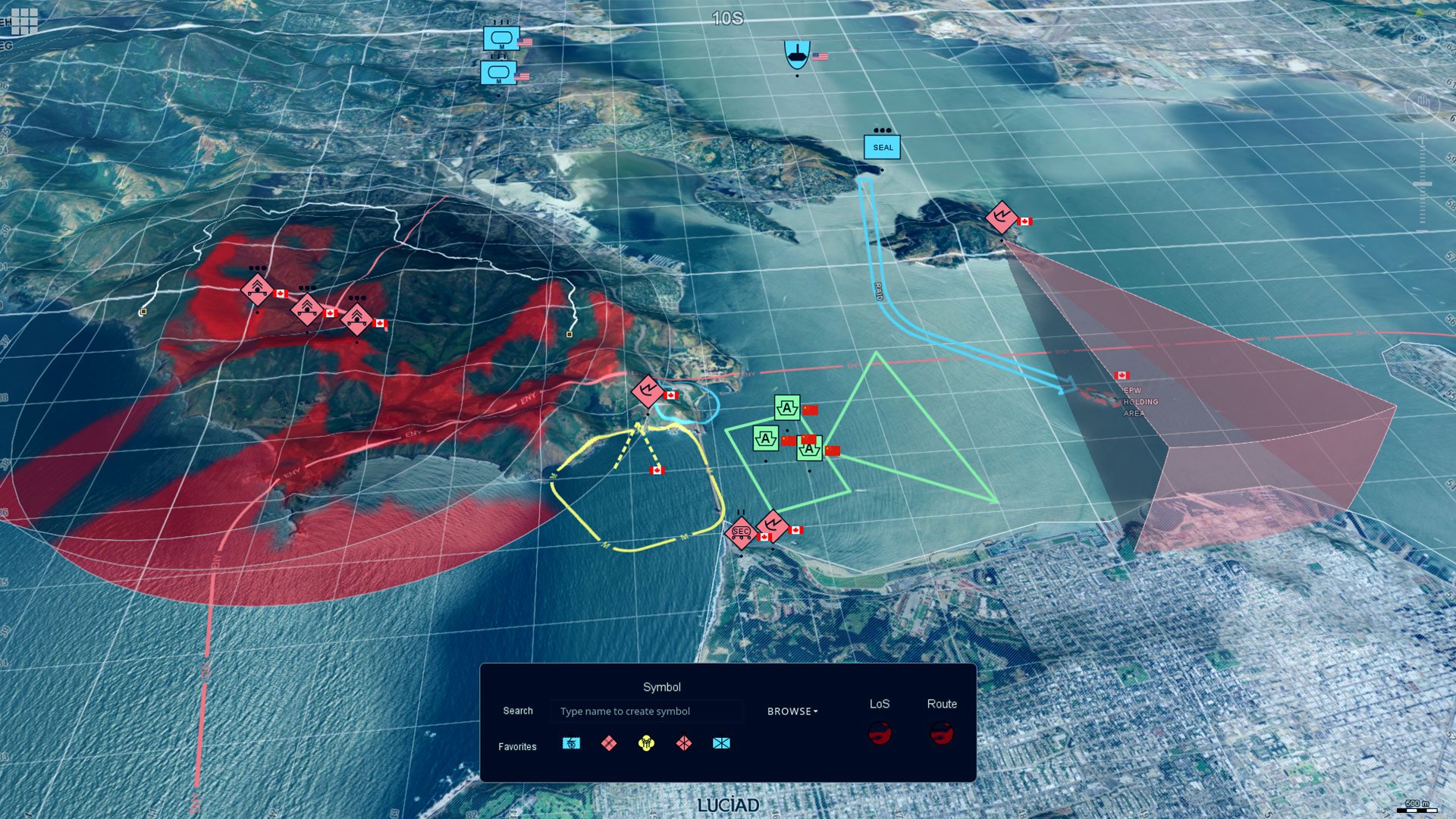
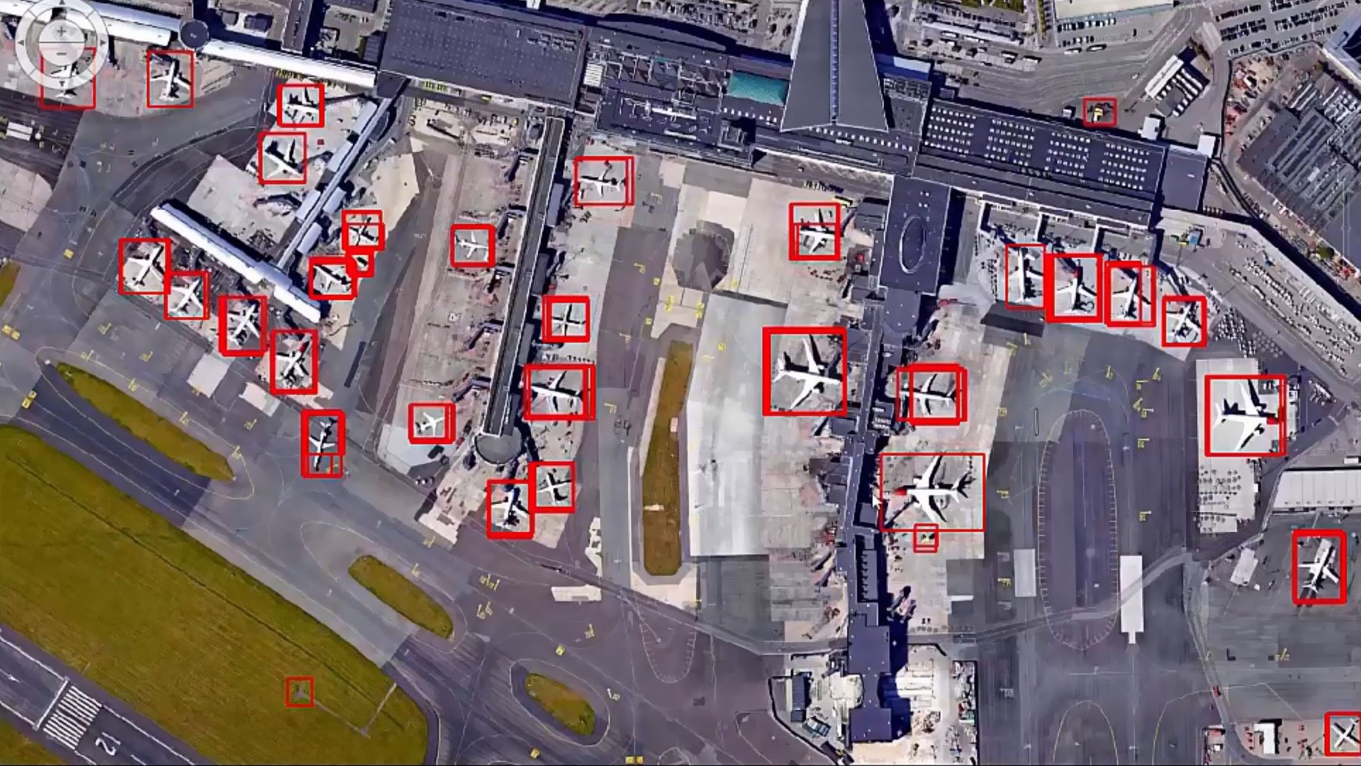
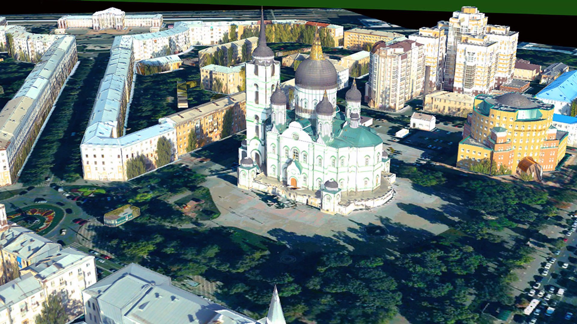
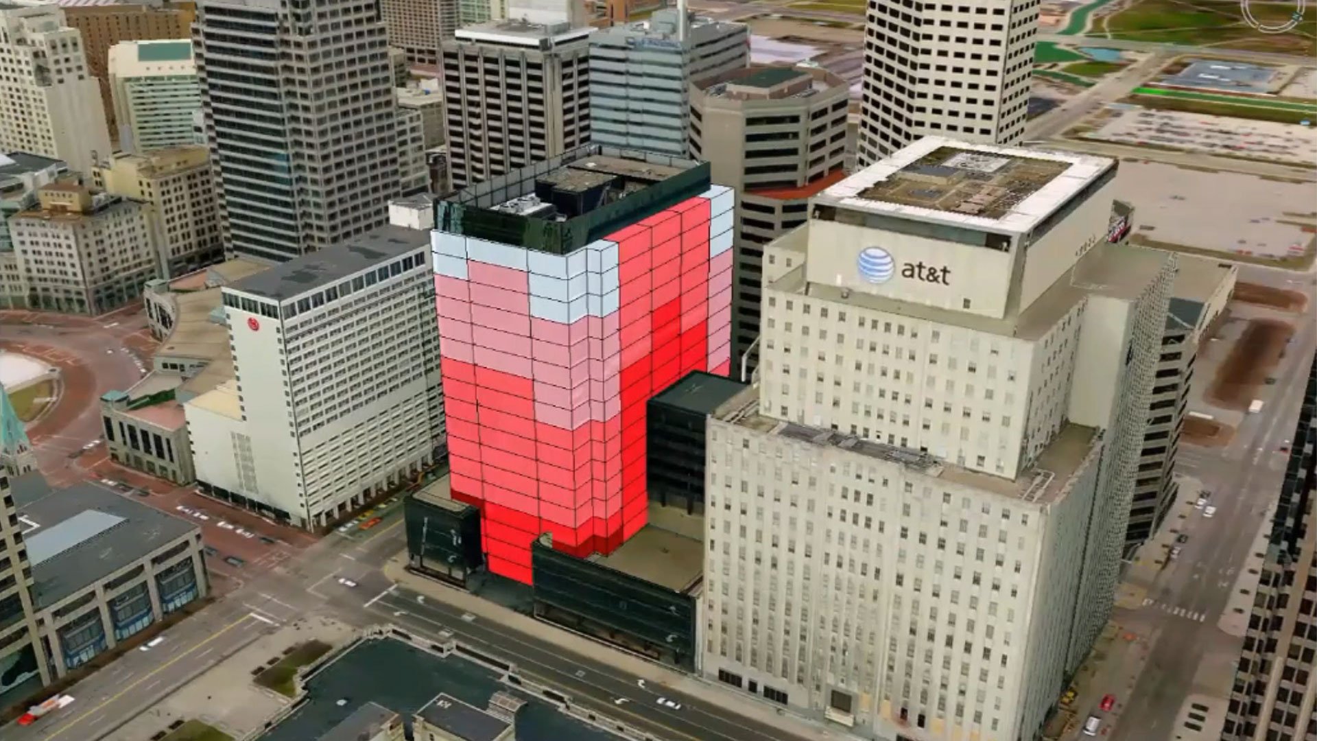
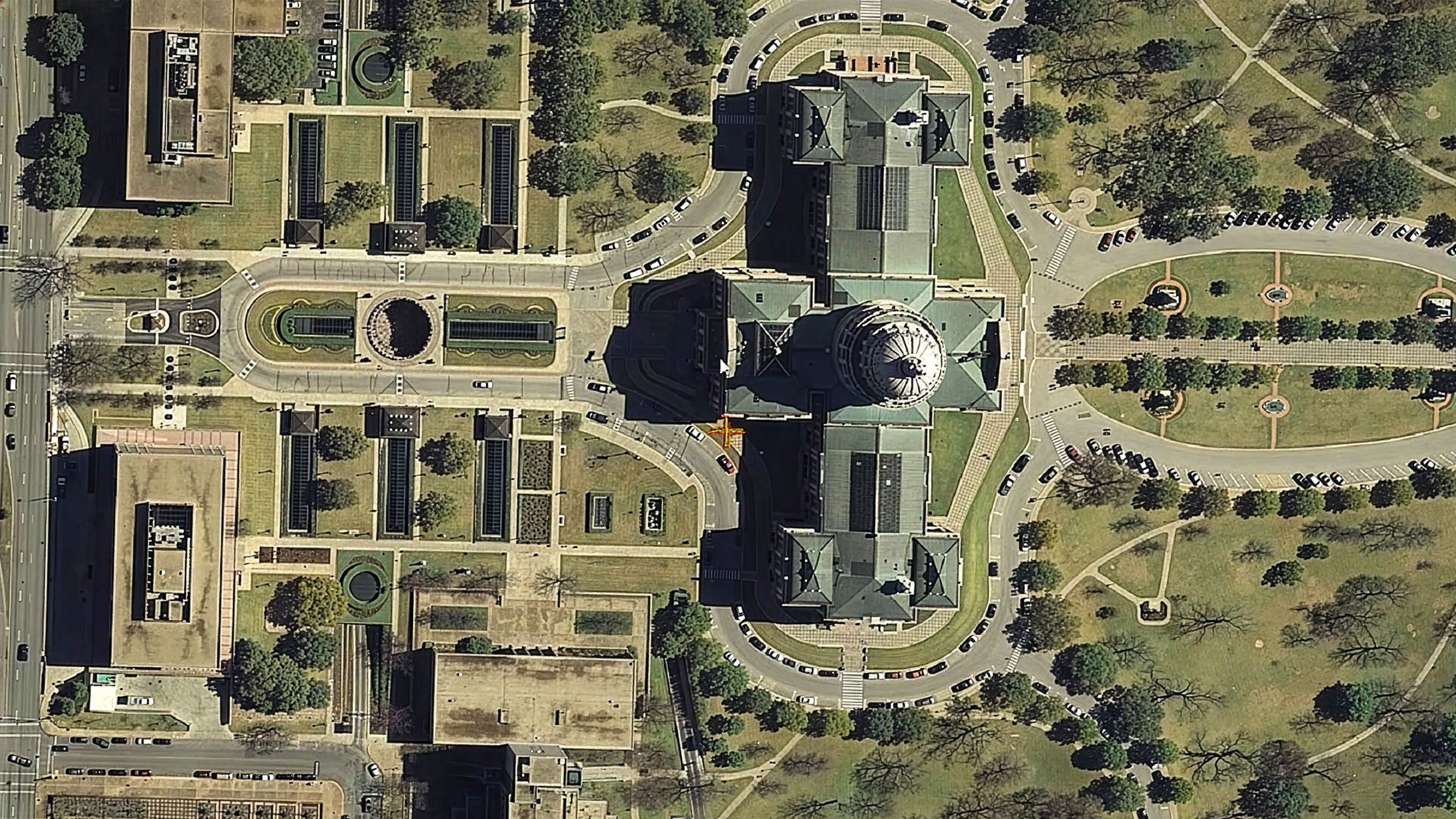
Advanced visualization in 2D and 3D
Create interactive maps, 3D models and dynamic reports. Display diverse data formats in one unified view to provide comprehensive spatial insights for better communication and decision-making.
Powerful spatial analysis tools
Perform network modeling, dynamic segmentation and spatial overlays efficiently. Advanced analysis tools enable users of all skill levels to extract actionable insights from complex geospatial data.
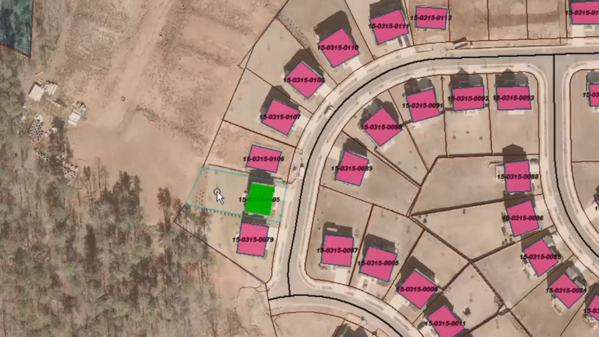
Seamless data integration
Support for 300+ data formats including CAD, GIS and database systems. Integrate information from multiple sources to create a unified view of your spatial data for comprehensive analysis.
Real-time data updates
Dynamically update analyses and visualizations as source data changes. Ensure your results are always current without redoing work, making GeoMedia ideal for time-sensitive applications and operations.
Industry-standard interoperability
Adhere to OGC protocols including WMS, WFS and WCS standards. Share geospatial data effortlessly across systems and collaborate seamlessly with other GIS tools and enterprise platforms.
Customizable workflows
Tailor user interfaces, workflows and analysis tools to align with your specific operational needs. Ensure seamless integration into your existing processes for maximum efficiency and productivity.
Explore the GeoMedia portfolio
GeoMedia is a powerful GIS platform that improves spatial data management. The wider GeoMedia portfolio encompasses a broad range of solutions. These include WebGIS, which transforms existing geospatial data into intuitive web applications; Octave ImageStation photogrammetry mapping technology; and Octave SafeHaul jurisdiction-based route optimization software that automates permitting, routing and restriction management for oversize / overweight (OS / OW) vehicles.

Extend and enhance your GeoMedia workflows
Unlock more capability in GeoMedia with a growing suite of add-ons designed to deepen analysis, streamline tasks and expand what your geospatial workflows can do. From advanced visualization to specialized data processing and operational tools, each add-on integrates seamlessly; helping you work smarter, faster and with greater confidence.
GeoMedia 3D offre una vista interattiva in 3D per esplorare chiaramente i modelli, il terreno e le immagini.
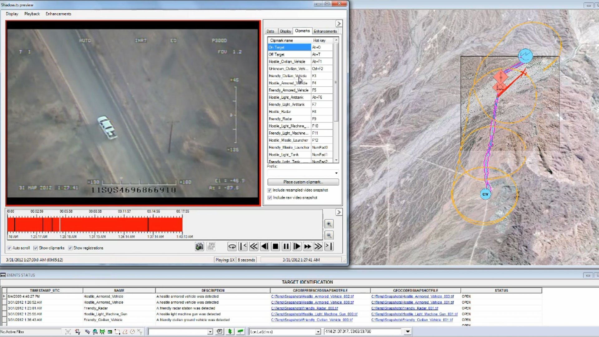
GeoMedia Motion Video consente di visualizzare, migliorare e analizzare i video degli UAV con dati geospaziali.
GeoMedia Mapping Manager migliora la cartografia con Map Publisher e Feature Cartographer.
GeoMedia Transportation Manager permette alle agenzie di modellare, analizzare e mantenere reti di trasporto lineari.
GeoMedia Viewer è un'applicazione GIS gratuita per la visualizzazione, l'analisi e la stampa dei dati cartografici.
Oggetti GeoMedia offre agli sviluppatori strumenti GIS e cartografici avanzati per applicazioni personalizzate.
Collezione GeoMedia Advanced ottimizza l'acquisizione e la validazione di dati vettoriali ad alto volume per l'MGCP e la mappatura internazionale.
GeoMedia GI Toolkit aggiunge strumenti per la produttività a GeoMedia Professional per la raccolta, l'integrazione e la mappatura dei dati più rapide.
GeoMedia Image Professional combina i flussi di lavoro GIS e di analisi delle immagini in un'unica soluzione integrata.
GeoMedia PDF crea file PDF intelligenti e georeferenziati direttamente dai fogli della mappa nella finestra di layout.
GeoMedia VPF fornisce un ambiente di produzione specializzato per la creazione di prodotti cartografici VPF digitali.
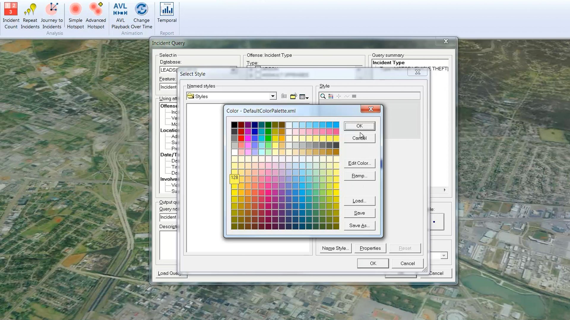
Analista degli incidenti GeoMedia fornisce un ambiente di mappatura intuitivo per l'analisi e la comprensione delle informazioni basate su eventi.
Spatial Modeler SDK è un toolkit C++ per creare, modificare ed eseguire flussi di lavoro su dati geospaziali.
Storie di successo dei clienti
Siamo qui per aiutarti
Ottieni l'aiuto di cui hai bisogno con accesso diretto a supporto e risorse.
Amplia le tue capacità geospaziali
Scopri i prodotti complementari che si integrano perfettamente con GeoMedia per potenziare le tue capacità GIS, di mappatura e di geolocalizzazione.